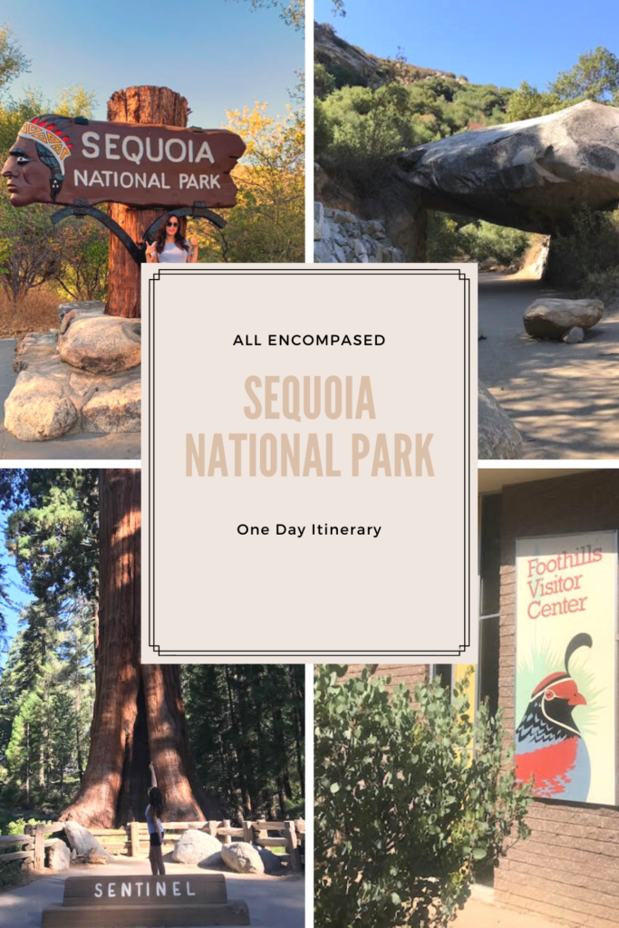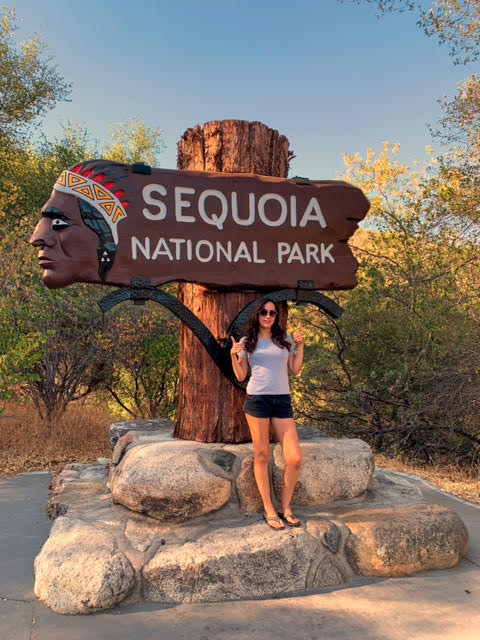
Sequoia National Park
Sequoia National Park was established in 1890 to protect the habitat where giant sequoia trees thrive.
Tips:
- Cell phone service is nonexistent in areas of the park, download offline maps in Google.
- Be prepared– bring food, snacks, and drinks with you.
- Finding food for purchase in the park may be difficult
- If you don’t have one already- consider purchasing the America the Beautiful Pass for $80
- It’s good for one year to ANY national park site instead of the $35 private vehicle pass that’s only good for a one week entry just to Sequoia & Kings Canyon National Park.
- Can be purchased at the toll booth when entering the park.
Sequoia National Park One Day All Encompassed Itinerary:
Following this one day itinerary you’ll get to see a bit of everything.
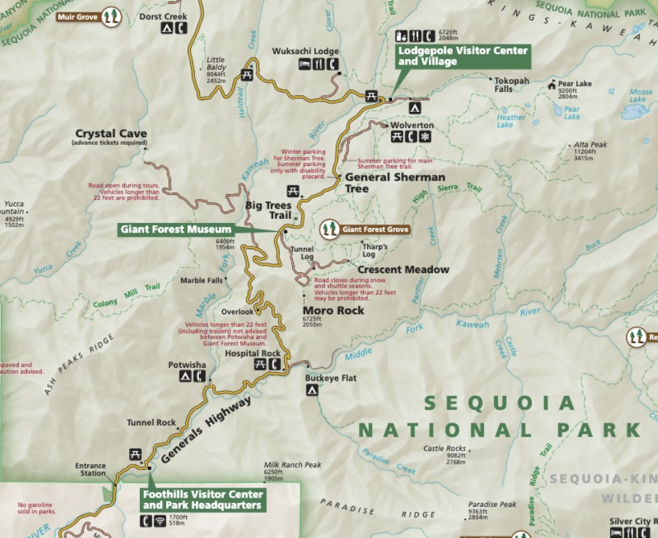
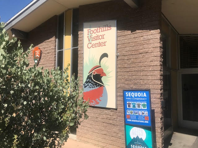
- 1. Start your day off by visiting the Foothills Visitors Center (exhibits may be closed due to the pandemic).
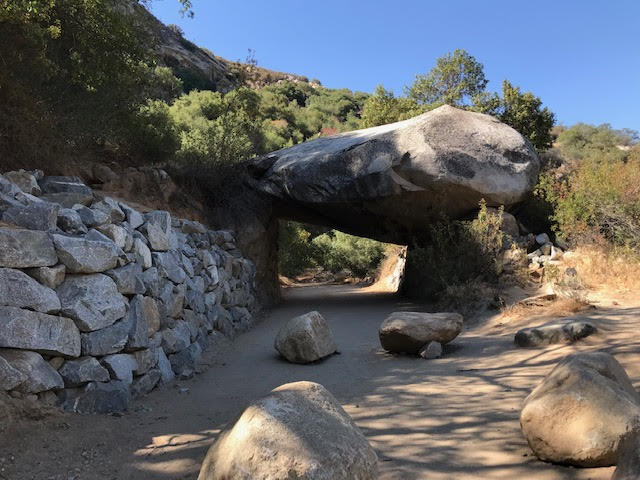
- 2. From there begin driving to your first stop to take a quick picture at Tunnel Rock.
- Tip: Tunnel Rock is a great photo opportunity, however a park ranger warned us about the poison ivy found around the rock.
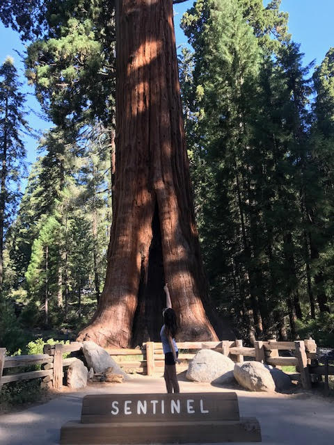
- 3. Giant Forest Museum (exhibits may be closed due to the pandemic)
- Visit the Sentinel Tree located in front of the museum
- 4. Our first trail of the day leaves from the museum’s parking lot- follow signs to The Big Trees Trail (1 mile).
- The Big Trees Trail is an easy, paved, walk around Rainbow Meadow, where you can read to learn about the giant Sequoias.
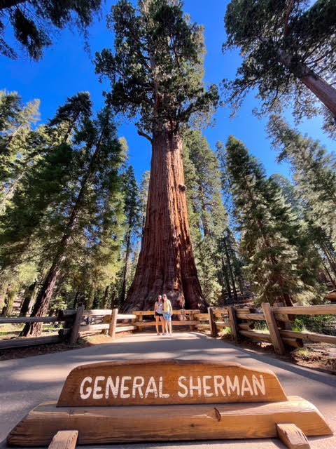
- 5. General Sherman – the biggest tree on Earth (by volume)
- To reach General Sherman you can either:
- Drive to the parking lot
- Hike 0.5 to General Sherman
- Use the free shuttle service available from the Giant Forest Museum (seasonal)
- Drive to the parking lot
- To reach General Sherman you can either:
- 6. Congress Trail (2 miles round trip)
- This trail begins very close to General Sherman
- An easy trail where you can walk through the Giant Forest to see the sequoias
- 7. Moro Rock (1 mile or 3.8 miles round trip if you decide to do the full hike)
- 350 stairs takes you to the top of the summit
- Reaching the trail- 2 options:
- Drive to the trailhead
- Use shuttle service available from the Giant Forest Museum (seasonal)
- 8. Drive Through Tunnel Log (0.5 mile drive from Moro Rock)
- Since 1935 people have driven through Tunnel Log.
- When this mighty sequoia fell on the road it was too big for workers to move.
- 8ft clearance, with a bypass lane for larger vehicles
- 9. Topokah Falls Trail (3.4 miles round trip)
- Takes you to a 1,200 ft cascading waterfall – best seen during the summer.
- Reaching the trail- 2 options:
- Drive to the trailhead
- Use shuttle service available from the Giant Forest Museum (seasonal)
Scenic Drives
If you have additional time- consider taking a Scenic Drive through the park(s). Following this itinerary you will drive through both Sequoia National Park & Kings Canyon National Park.
- Generals Highway from the Sequoia Park Entrance to Lodgepole (1 hour)
- Stop at these viewpoints along the drive:
- Hospital Rock: View Native American pictographs and mortars.
- Amphitheater Point: Gorgeous viewpoint of Moro Rock.
- Eleven Range Overlook: Viewpoint of California’s Coast (only on clear days).
- Beetle Rock: Striking views of granite formations.
- Crescent Meadow: View ancient Sequoias surrounding a meadow.
- Stop at these viewpoints along the drive:
- Generals Highway from Lodgepole to Grant Grove (45 minutes)
- Stop at these viewpoints along the drive:
- Halstead Meadow: A bridge goes over this large meadow with beautiful wildflowers.
- Redwood Mountain Overlook: View the largest sequoia grove here.
- Kings Canyon Overlook: Expansive wilderness views of both parks.
- Stop at these viewpoints along the drive:
- Grant Grove to the Kings Canyon and Cedar Grove (45 minutes)
- Stop at these viewpoints along the drive:
- Junction View: Viewpoint of the Middle Fork & South Fork of Kings Canyon.
- Yucca Point: Viewpoint of a foaming junction of the Middle Fork and the South Fork of the Kings River.
- Hwy 180 between Yucca Point and Boyden Cave: Drive through a section of the road blasted out of the sheer walls of Kings Canyon.
- Boyden Cave: View layers of marble between volcanic rock. Tours of the cave are available during the summer (book in advance).
- Grizzly Falls: 5 minute walk to view falls.
- Canyon View: Viewpoint of the U-shaped Kings Canyon, carved out by a glacier.
- Roaring River Falls: View a small waterfall cascade through a granite chute.
- Zumwalt Meadow: Walk along the boardwalk to see the meadow or do the 1.5 mile loop trail to see the high granite walls and the Kings River.
- Roads End: Viewpoint for high granite walls, access to river trails, and Muir Rock.
- Stop at these viewpoints along the drive:
Additional Site to See Nearby:
If you have time- Consider visiting the Trail of 100 Giants, located in Porterville California, $10 a vehicle for parking.